Chicago's West Side Is an Air Pollution Hotspot, New Study Finds
09/22/2023
The western edge of Chicago—including the North and South Lawndale, East Garfield Park, Archer Heights and Brighton Park neighborhoods—experiences up to 32% higher concentrations of nitrogen dioxide (NO2) air pollution compared to the rest of the city, a new Northwestern University study has found.
In the new study, researchers developed a process to systematically identify areas of agreement and disagreement among three individual state-of-the-art air-quality datasets: satellite observations, a simulation developed at Northwestern and sensors from Microsoft Research's Project Eclipse.
Although one or two datasets identified multiple areas as NO2 hotspots, all three datasets consistently flagged Chicago's West Side as having elevated NO2 pollution. The West Side also has more Black, Hispanic and Latinx residents compared to the rest of the city, highlighting the disproportionate pollution and health burdens shouldered by these communities.
The study was published in Environmental Research Letters.
"The three tools that we explored sometimes identified different areas of elevated pollution from one another," said Northwestern's Anastasia Montgomery, who led the study.
"That doesn't necessarily mean the tools are not working. It could be that they are looking at different things. However, in areas where we found agreement between the datasets, we have greater confidence that NO2 pollution is significantly high. The three different tools we used all pointed to the West Side as an area where pollution is significantly elevated relative to the Chicago average."
"High spatial resolution air quality data has the potential to reveal inequitable exposure to pollution by identifying localized hotspots," said Northwestern's Daniel Horton, the study's senior author. "Using this science-backed evidence, residents can advocate for change, and government officials can develop more targeted policies. By combining and improving tools to identify these hotspots, we can ensure that mitigation efforts serve the most affected communities."
Horton is an assistant professor of Earth and planetary sciences at Northwestern's Weinberg College of Arts and Sciences, where he leads the Climate Change Research Group. Montgomery recently completed her Ph.D. as a member of Horton's research group.
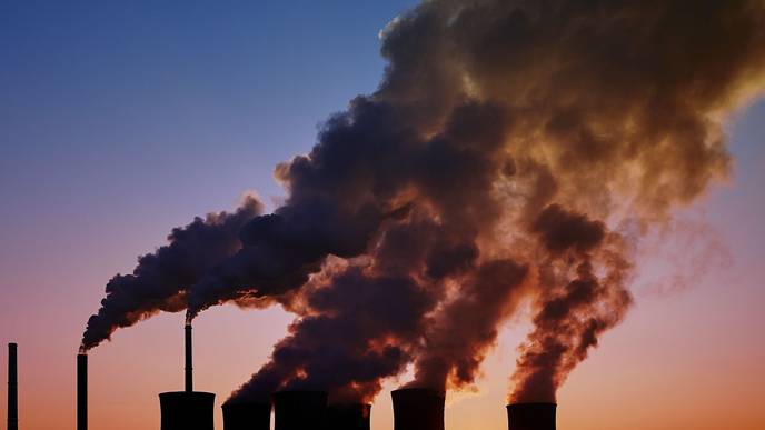
To conduct the study, the researchers compared how each dataset quantified NO2. A byproduct of fossil-fuel combustion engines, NO2 is incredibly harmful to human health. Chronic exposure to these fumes can lead to bronchitis, pneumonia, asthma and even premature death. And under certain conditions, when NO2 interacts with sunlight, it can also produce ground-level ozone, which is linked to childhood asthma and other respiratory health issues.
Each tool in the study used a different method to gather data. Microsoft Research's Project Eclipse collected real-time air-quality data by deploying 100 low-cost sensors throughout Chicago, which sampled the air every one minute. Previously developed in Horton's laboratory, the Northwestern simulation combines emissions data with weather and chemical transport models to create neighborhood estimates of air quality. And the satellite tool takes a snapshot of Earth's atmosphere once per day.
"Satellite tools are sensitive to different wavelengths of light," Montgomery explained. "Nitrogen dioxide absorbs light at certain wavelengths, so satellite snapshots can reveal different levels of nitrogen dioxide concentrations across space."
Because air pollution changes across seasons, the researchers looked at air quality data in February and August. Then, they pinpointed neighborhoods with high agreement (meaning all tools agree), medium agreement (two tools agree) and low agreement (consensus among none of the tools) regarding NO2 hotspots.
All tools consistently identified the city's West Side as a hotspot in both August and February, regardless of season or wind direction. Depending on the month, the estimated 501,000 people who live and work within this hotspot experience NO2 concentrations that are 16 to 32% higher than the city-wide average.
Data from satellites and Microsoft Research's sensors also pinpointed an adjoining hotspot just a bit north of the consensus hotspot, encompassing the Austin, Humboldt Park and West Garfield Park neighborhoods. The Northwestern simulation, however, did not indicate a hotspot in this area.
"Our model does not simulate significantly high pollution concentrations here, but observations show otherwise," Montgomery said. "Because the model simulations don't agree with two observational datasets, it suggests that our model has limitations. Perhaps we need to adjust the model physics or the underlying emission estimates."
Another area of medium agreement occurred along highways. While satellite data and the Northwestern simulation uncovered high NO2 along highways, the Microsoft Research data did not.
"We think that's because most highways in Chicago are typically above street level," Montgomery said. "Microsoft placed sensors at bus stops, which are always at street level, so they didn't capture the elevated interstate corridors well."
Even though the tools might disagree on hotspots, the causes behind the hotspots are certain. All areas with high or medium agreement are considered heavily trafficked and moderately to highly industrialized.
"Tools like those we used in this study can be used as complementary components for monitoring a city to show where targeted inventions are most needed," Montgomery said. "We can look at the zoning there and who is being affected. Policies could be implemented to incentivize engine idling restrictions, building standards or the purchase of electric vehicles."
More information: Anastasia Montgomery et al, Intraurban NO2 hotspot detection across multiple air quality products, Environmental Research Letters (2023). DOI: 10.1088/1748-9326/acf7d5
Citation: Chicago's West Side is an air pollution hotspot, new study finds (2023, September 21) retrieved 21 September 2023 from https://phys.org/news/2023-09-chicago-west-side-air-pollution.html
This document is subject to copyright. Apart from any fair dealing for the purpose of private study or research, no part may be reproduced without the written permission. The content is provided for information purposes only.
Facebook Comments